Photos: Alison Leschen
Restoring the River

Coonamessett River before, during, and after restoration.


Background
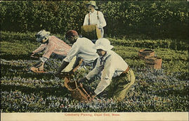
The Coonamessett River Valley in Falmouth, Massachusetts has seen dramatic changes over the last 400 years, primarily due to evolving use by people. For thousands of years, Native Wampanoag gathered the abundant natural resources, with little long-term impact. Arrival of European settlers in the 1600s began a series of alterations to the river that would span centuries. Use of water power to fuel grist- and then woolen mills, then conversion to cranberry farming, had a profound impact on the river and surrounding wetlands. Once host to throngs of herring, American eel, and Brook trout, fish populations had dwindled to almost nothing by the 1900s. Other animal and plant communities also changed considerably.
In 2002, the Coonamessett River Trust began advocating for river restoration by sponsoring several Town Meeting articles. We also started systematically monitoring the river’s biological, chemical, and physical conditions. Over time, we persuaded the Town to retire the cranberry bogs and actively restore the river. The 300 Committee Land Trust of Falmouth (T3C), sometimes in partnership with the Town, also began strategically acquiring land along the river to establish a vegetated buffer from Coonamessett Pond nearly to Great Pond.
Project goals are to:
-
establish a healthy, self-sustaining river and wetland ecosystem that supports fish, other aquatic organisms, and wildlife;
-
increase resiliency of the coast as storms get stronger, by removing blockages and creating connection to the floodplain.
-
increase recreational and educational opportunities for people of all ages to discover the environmental, land use, and cultural history surrounding the river.
Active restoration began in 2017 with:
Phase 1 -- Dexter's Mill Crossing to Middle Dam completed in 2018.
Phase 2 -- Swift's Crossing – formerly Middle Dam – to Pond 14 and a new culvert/bridge at John Parker Road Crossing completed in 2020.
Phase 3 -- Upper Coonamessett River --north of private cranberry bogs on Thomas Landers Rd. to Hatchville Rd.
Results to date
Results in Phase 1 of our first two goals have exceeded the expectations of even seasoned scientists. One of the most fascinating aspects was that seeds from wetland plants that had been buried for 300 years under mill ponds and cranberry bogs sprung to life once original wetland soils were uncovered.
CRT, with the help of T3C, is achieving the third goal. Learn more about our educational programs here. A trail – the Coonamessett Greenway Heritage Trail – now runs about 3.5 miles along both sides of the river with multiple loops along the way.
Watch a video describing the restoration and results of Phase 1.

Brass Plaque: Sarah Peters
Photos: Courtesy Falmouth and Woods Hole Historical Societies.